forums
new posts
donate
UER Store
events
location db
db map
search
members
faq
terms of service
privacy policy
register
login


Location DB > Canada > Quebec > Montérégie Area > Soulanges Canal > Aerial Views and Maps > 6

6 / 9   6

Description
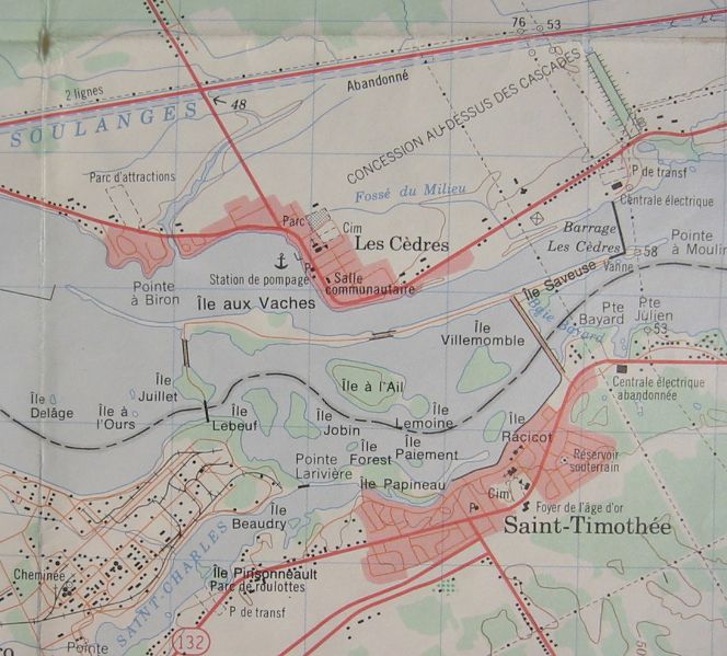
Les Cedres area map. Detail from 1980 1:50,000 NTS topo map 31 G/8, "Vaudreuil". Soulanges Canal Lock 4 is at top right. I'd like to learn more about that depressed area connecting the canal to the river. It must have been some kind of run-off chute.
Controls

Return to Main Location Page

Return to Gallery Overview

Edit this Gallery

Edit this Picture

Un-Subscribe this Picture
Comments
Posted by nostra-YOUPPI! 7/26/2004 1:14 AM | remove
  like i have said its the canal that used to feed provincial light and power and its also the run off from la petite energie
Posted by nostra-YOUPPI! 7/26/2004 1:20 AM | remove
  actually i re checked it is the only serving provincial light and power. directly across from canadian light and power
If you'd like to add a comment, please login or register.


All content and images copyright © 2002-2024 UER.CA and respective creators. Graphical Design by Crossfire.
To contact webmaster, or click to email with problems or other questions about this site: UER CONTACT
View Terms of Service | View Privacy Policy | Server colocation provided by Beanfield
This page was generated for you in 406 milliseconds. Since June 23, 2002, a total of 739645522 pages have been generated.