forums
new posts
donate
UER Store
events
location db
db map
search
members
faq
terms of service
privacy policy
register
login


Location DB > Canada > Ontario > Cornwall > Cornwall Canal > Maps and Historical > 8

8 / 13   8

Description
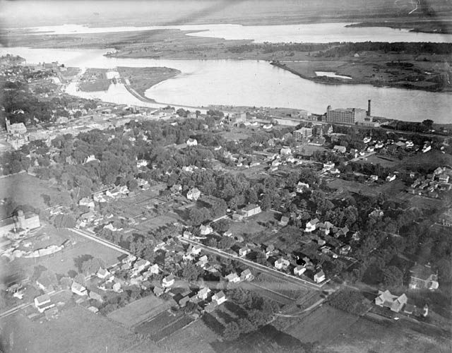
An aerial view of Cornwall in 1920, looking downriver. At left you can see the entrance to the canal and the dry dock. McCarthy Aero Service photo.

Picture source: Library and Archives Canada
Controls

Return to Main Location Page

Return to Gallery Overview

Edit this Gallery

Edit this Picture

Un-Subscribe this Picture
Comments
Posted by BravoOrig 3/5/2008 1:27 PM | remove
  So is this town all gone now?
Posted by nostra-YOUPPI! 3/5/2008 3:36 PM | remove
  no the dam is upstream, but look up moulinette, mile roches and iroquois ontario
If you'd like to add a comment, please login or register.


All content and images copyright © 2002-2024 UER.CA and respective creators. Graphical Design by Crossfire.
To contact webmaster, or click to email with problems or other questions about this site: UER CONTACT
View Terms of Service | View Privacy Policy | Server colocation provided by Beanfield
This page was generated for you in 375 milliseconds. Since June 23, 2002, a total of 739791739 pages have been generated.