|
|
|
UER Store
|
|
 order your copy of Access All Areas today!
|
|
|
|
Activity
|
|
880 online
Server Time:
2024-04-26 08:46:13
|
|
|
 NotBatman
    
Location: MSP
Gender: Male
Total Likes: 443 likes

Secret Cult Member
 | |  | |  | Re: Location Organization
< Reply # 8 on 7/26/2017 1:17 PM >
| Reply with Quote
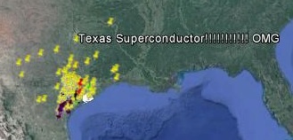
| | | I'm really happy with Google Maps.
Different colors/styles of pins and markers to designate different kinds of places (aboveground vs below, explored vs not, worth a trip back, demolished, etc.
It also lets me work in layers, though I wish it would allow for more layers. Currently I have a layer for in town, a layer of "Unconsolidated Outer Nonsense" that can really be anything, a layer each for two or three of the places I like to travel to and what can be done there, a layer simply for photography and camping.
Mostly I only use it for jotting quick notes about a place or to get directions there while I'm out.
It does everything I need it to really well, and I can open it in Google Earth for remote scouting, or whatever.
|
I'm a "Leave only footprints, take only pornography" kind of guy, myself. |
|
Aran
  
Location: Kansas City
Gender: Male
Total Likes: 1848 likes

Huh. I guess covid made me a trendsetter.
| | | Re: Location Organization
< Reply # 10 on 8/8/2017 4:05 AM >
| Reply with Quote
| | | Posted by NotBatman
I'm really happy with Google Maps.
Different colors/styles of pins and markers to designate different kinds of places (aboveground vs below, explored vs not, worth a trip back, demolished, etc.
It also lets me work in layers, though I wish it would allow for more layers. Currently I have a layer for in town, a layer of "Unconsolidated Outer Nonsense" that can really be anything, a layer each for two or three of the places I like to travel to and what can be done there, a layer simply for photography and camping.
|
Indeed. Does this have the same level of customizability as Google Maps? I have my locations organized like so: ColorGreen= Confirmed to exist, fully exploredYellow= Confirmed to exist, unexploredRed= Existence unconfirmed ShapePin= Currently abandoned Diamond= Demolished or repurposed LayersLayer 1= Abandonments Layer 2= Rooftops, cranes, drains, and tunnels Layer 3= Demolished, repurposed, or mistaken for abandoned I also have a little description attached to each location with details such as features, hazards, history, and date explored. If this new app has all these functionalities, it would be nice to have them easily available. Otherwise, I'll stick with Google Maps.
[last edit 8/8/2017 4:07 AM by Aran - edited 2 times]
|
"Sorry, I didn't know I'm not supposed to be here," he said, knowing full well he wasn't supposed to be there.
|
|
Dee Ashley

Location: DFW, Texas
Gender: Female
Total Likes: 1378 likes

Write something and wait expectantly.
| | |  | Re: Location Organization
< Reply # 11 on 8/15/2017 10:42 AM >
| Reply with Quote
| | | Posted by Aran
Indeed. Does this have the same level of customizability as Google Maps? I have my locations organized like so:
Color
Green= Confirmed to exist, fully explored
Yellow= Confirmed to exist, unexplored
Red= Existence unconfirmed
Shape
Pin= Currently abandoned
Diamond= Demolished or repurposed
Layers
Layer 1= Abandonments
Layer 2= Rooftops, cranes, drains, and tunnels
Layer 3= Demolished, repurposed, or mistaken for abandoned
I also have a little description attached to each location with details such as features, hazards, history, and date explored.
If this new app has all these functionalities, it would be nice to have them easily available. Otherwise, I'll stick with Google Maps.
|
This sounds a lot like my setup, except my green waypoints indicate the locations I really want to see the most. Only about 5% or so of my waypoints ever make it to green status. 
|
I wandered till the stars went dim. |
|
Rot

Location: Colorado
Gender: Male
Total Likes: 15 likes

Cya
| | | Re: Location Organization
< Reply # 12 on 8/15/2017 6:05 PM >
| Reply with Quote
| | | Posted by Aran
Indeed. Does this have the same level of customizability as Google Maps? I have my locations organized like so:
Color
Green= Confirmed to exist, fully explored
Yellow= Confirmed to exist, unexplored
Red= Existence unconfirmed
Shape
Pin= Currently abandoned
Diamond= Demolished or repurposed
Layers
Layer 1= Abandonments
Layer 2= Rooftops, cranes, drains, and tunnels
Layer 3= Demolished, repurposed, or mistaken for abandoned
I also have a little description attached to each location with details such as features, hazards, history, and date explored.
If this new app has all these functionalities, it would be nice to have them easily available. Otherwise, I'll stick with Google Maps.
|
This is actually a really helpful way to organize this kind of stuff, thank you !
|
feel. alive. |
|
|
| This thread is in a public category, and can't be made private. |
|
All content and images copyright © 2002-2024 UER.CA and respective creators. Graphical Design by Crossfire.
To contact webmaster, or click to email with problems or other questions about this site:
UER CONTACT
View Terms of Service |
View Privacy Policy |
Server colocation provided by Beanfield
This page was generated for you in 187 milliseconds. Since June 23, 2002, a total of 739206018 pages have been generated.
|
|