By popular demand, I went back today and got photos of the walk from the bottom of the road to the top. I didn't document every single part of it, just the parts that I thought would make good photography. I'll do my best to narrate as we take a journey together.
At the end of a small housing complex is this gravel road and sign. It doesn't say no trespassing or anything, but there is a marker to try and dissuade you from entering.

There is a couple miles of this. You can drive it since there isn't anything stopping you - aside from the "DO NOT ENTER" sign in the previous photo.

There is a coal mine entrance at the end of the road before the road blocks, so they do keep this part somewhat maintained. I'm not sure if the coal mine pays the bill or if the township does.

Eventually you get to a barrier. This is where you have to park, the next 3 miles are on foot.

To the left of the barrier in the above photo is the mine entrance. It is fenced off. This is not the way I went today, but it IS the way I came back. I will explain that more later on.

About a half mile from the barrier. Same perspective as my original post, but this time taken landscape with a fisheye.

This guardrail feels so alone.

Looking back down the road.

Headed up another hill.

Another hill. Took this photo from the top, looking back down.

When you get to a certain point, the guard rail turns into the old cable type. Ancient. I liked the log in this photo.

End of the road. This is the barrier that prevents cars from accessing it from the neighboring town.

There were bones on one of the barriers. Don't know enough about bones to identify which animal.

This is where you may think the story ends, but it doesn't. We had noticed a bright orange lake when we we were walking up one of the hills. The entire time we were hiking, we were looking for a way down the hillside to eventually get back to that lake. I just knew I had to photograph it.
So, we went beyond those barriers in the above photo and found a section of the hillside that could be hiked. There wasn't a path to be found, so we blazed through the weeds and held onto large trees. It took us about 20 minutes to descend into the valley.
Once down there, we got these shots of the lake. As this is near a mine entrance, I assume the lake is polluted with Sulfur.


We hiked out of there via the lower access road, which brought us past the coal mine entrance (sorry - had hidden the camera gear by this point so no photos) and then back out through the fence.


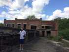
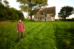
 It certainly doesn't need to be an abandoned building to tell an interesting story. I would enjoy following the road, see what's on it.