forums
new posts
donate
UER Store
events
location db
db map
search
members
faq
terms of service
privacy policy
register
login


Location DB > United States > California > Morgan Hill > Uvas Reservoir Ruins > Some ruins - day photos > IMG_1932

6 / 9   IMG_1932

Description
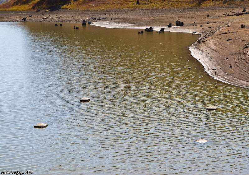
Tops of concrete piers for an old bridge that crossed the creek. Barely poking out of the water. If the reservoir level dips lower than 1.4%, I'll swing back and see if the bridge is more visible. Note the rows of tree trunks in the background. All of these trees were cut down in 1957 when they flooded the area when the dam was completed.
Controls

Return to Main Location Page

Return to Gallery Overview

Edit this Gallery

Edit this Picture

Un-Subscribe this Picture
Comments
Posted by seany 9/26/2007 3:31 AM | remove
  do you know if they're planing on dropping it down low enough to see that?
Posted by cambrianguy 9/26/2007 8:37 AM | remove
  I think so. The day before, it was at 4.4%. This morning, 1.4%. This late afternoon 1.2%. So I think they are still discharging water to the valley aquifers. Only a matter of time before we can see this bridge. Can't wait!
Posted by Brooks 10/19/2007 9:08 PM | remove
  get a waterproof camera and go for a swim! Sweet pictures would be made
Posted by cambrianguy 10/19/2007 10:01 PM | remove
  Don't need to....
http://www.flickr....pshift/1572446880/
If you'd like to add a comment, please login or register.


All content and images copyright © 2002-2024 UER.CA and respective creators. Graphical Design by Crossfire.
To contact webmaster, or click to email with problems or other questions about this site: UER CONTACT
View Terms of Service | View Privacy Policy | Server colocation provided by Beanfield
This page was generated for you in 359 milliseconds. Since June 23, 2002, a total of 739816751 pages have been generated.