forums
new posts
donate
UER Store
events
location db
db map
search
members
faq
terms of service
privacy policy
register
login


Location DB > Canada > Ontario > Whitby > Whitby Psychiatric Hospital > Rainman's Training Maps from 1988 > WPH Map1988a.JPG

1 / 3   WPH Map1988a.JPG

Description
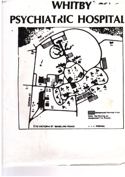
This is a photocopy from the main map Security used in 1988. This gave an overview of the layout of the grounds. Not included was a farmhouse that was along the west boundary of the grounds. It was the last of several farmhouses that stood there. The others were demolished before I started there and this one although not boarded up and still connected was abandoned. The front stairs were removed from the porch after I went through the bottom step (I wasn't hurt.) and the house was really cool to check out. Also, the 'X' was put through building #24 as it was already torn down shortly before I started. (probably a month or two as I could make out the building's footprint at the time.)
Controls

Return to Main Location Page

Return to Gallery Overview

Edit this Gallery

Edit this Picture

Un-Subscribe this Picture
Comments
If you'd like to add a comment, please login or register.


All content and images copyright © 2002-2024 UER.CA and respective creators. Graphical Design by Crossfire.
To contact webmaster, or click to email with problems or other questions about this site: UER CONTACT
View Terms of Service | View Privacy Policy | Server colocation provided by Beanfield
This page was generated for you in 375 milliseconds. Since June 23, 2002, a total of 739327464 pages have been generated.