|
|
|
UER Store
|
|
 order your copy of Access All Areas today!
|
|
|
|
Activity
|
|
563 online
Server Time:
2024-04-23 11:00:08
|
|
|
 |
|
|
|
|
Location DB >
United States >
New York >
Freeport >
Water Works
|
|
Log in to activate viewing options
|
|
|
 |
Publically Viewable |
|
This location has been labeled as Demolished, and therefore can be viewed by anyone.
|
|
|
|
|
|
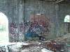
Type: Building
Status: Demolished
Accessibility: Easy
Recommendation: forget it its gone
|
|
|
|
|
|
|
|
|
|
|
|
|
From Bygone Long Island:
The history of the property dates to the late 17th century, when John Pine received permission to operate a grist mill at Milburn and Merrick roads. At that time, the creek that runs through the preserve was dammed to form the body of water known today as Milburn Pond. In the 1880s, this property, along with several other Long Island streams, was purchased by the City of Brooklyn to supply water to its growing population.
To help the water along, a large pumping station was erected on the Freeport-Baldwin border. The Milburn Pumping Station in Freeport turned out to be one of the most extraordinary and beautiful industrial structures ever built on Long Island. Frank Freeman, a Brooklynite and a master of Romanesque revival architecture, was commissioned to design the 300-foot-long pumping structure.
Work began on the conduits and pumping station in 1890. By the end of the next year, the pumping station was almost completed and its equipment was tested.
Unfortunately, there was still a gap in the pipes at Rockville Centre and the huge surge of water inundated workers. But a week later the pumping station was pushing water to Brooklyn around the clock. By 1907 the system was supplying about 85 percent of the 145 million gallons a day consumed in Brooklyn.
The creation of Greater New York City in 1898 put the New York City Board of Water Supply in control. By 1917, a new Catskill aqueduct started 12 years before was supplying most of the city's water.
In the 1920s the city began paying Nassau County $80,000 a year in taxes for the water system property. To cut their tab, city officials suggested building a highway above their pipeline. The state Legislature authorized the plan, and the result was Sunrise Highway. It was dedicated on June 8, 1929.
The city also dedicated 2,200 acres in Nassau to the Long Island State Park Commission in 1925. This land would be transformed into the Southern State, Meadowbrook, Wantagh and Bethpage Parkways and Valley Stream and Hempstead Lake State Parks.
While the city retained the right to pump water, its dependence on the old system continually dropped until it was used only in emergencies, the last time in a 1965-66 drought.
In 1977, when the system was obsolete, Nassau gained ownership of the pumping station. The county obtained the property around the station and 1,750 additional acres of watershed land four years later.
The remaining water system property was purchased by the county in 1986.
|
|
|
|
|
|
|
|
|
|
|
|
|
The moderator rating is a neutral rating of the content quality, photography, and coolness of this location.
This location has not yet been rated by a moderator.
|
|
 This location's validation is current. It was last validated by
Opheliaism on 4/2/2012 12:37 PM.
This location's validation is current. It was last validated by
Opheliaism on 4/2/2012 12:37 PM.
|
|
|
on Apr 2 12 at 12:37, Opheliaism validated this location
on Apr 2 12 at 5:14, Radio2600 changed the following: Owner, City, Latitude, Longitude, Co-ordinate Accuracy, History
on Apr 2 12 at 5:07, Radio2600 changed the following: History, Year Built, Year Closed, Web Links
on Apr 2 12 at 4:48, Radio2600 added some pictures to a gallery
on Apr 2 12 at 4:47, Radio2600 added some pictures to a gallery
on Apr 2 12 at 4:40, Radio2600 updated gallery August 18, 2006 Fire
on Apr 2 12 at 4:38, Radio2600 created a new gallery
on Jan 18 12 at 0:54, Opheliaism validated this location
on Jan 18 12 at 0:52, Opheliaism changed the following: City
on Jan 17 12 at 18:37, topbladenyc made this location public
|
|
|
|
|
|
|
Is this location inappropriate / broken / missing key info?
If it's something you can fix, please scroll up and click the EDIT button.
If this location was only posted a few days ago, give the creator time to work on it.
Please try sending a message directly to the creator of the location. You'll find that info at the top of this page.
Otherwise, ONLY if you've already tried to contact the original creator,: Click here to notify an administrator.
|
|
|
|
All content and images copyright © 2002-2024 UER.CA and respective creators. Graphical Design by Crossfire.
To contact webmaster, or click to email with problems or other questions about this site:
UER CONTACT
View Terms of Service |
View Privacy Policy |
Server colocation provided by Beanfield
This page was generated for you in 93 milliseconds. Since June 23, 2002, a total of 738787134 pages have been generated.
|
|