|
|
|
UER Store
|
|
sweet UER decals:

|
|
|
|
Activity
|
|
526 online
Server Time:
2024-04-16 10:08:40
|
|
|
 |
|
|
|
|
Location DB >
United States >
New Hampshire >
Weare >
Clough State Park
|
|
Log in to activate viewing options
|
|
|
 |
Publically Viewable |
|
This location has been labeled by its creator as Public, and therefore can be viewed by anyone.
|
|
|
|
|
|
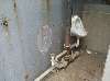
Clough State Park is located off Everett Dam Road in both Dunbarton, and Weare. The main entrance is gated off, so you must park down the road at the dam parking lot and walk down.
EDIT 11/2015: The park has been reopened and is now a summer spot for locals, nothing exciting.
|
|
|
Type: Outdoors
Status: Repurposed
Accessibility: Easy
Recommendation: forget it
|
|
|
|
|
|
This probably has the most effect on people who grew up going to this beach every summer. It was a place of fun, wholesome time with the family, and reminds one of a simpler time. Now one walks along the rocky, partially overgrown beach and can't help but wonder what has happened to one of the area’s best swimming lakes.
|
|
|
|
|
|
|
|
|
The 2006 Mother's Day flood caused the park to be closed for the entire season, 2007 followed with another flood which closed the park for yet another season, and in 2008 the state department made a decision to close hundreds of parks in New Hampshire due to financial reasons - Clough State Park was one of them. The park itself is open to the public, however the main gate is usually closed, and no upkeep is being done with the beach, roads, or the bathrooms.
FROM THE STATE PARK WEBSITE:
The Piscataquag River, which flows 14 miles through the town of Weare was once one of the best sources of water power in the state. In the early 1900s 22 mill sites had been located along the banks of the river in the Weare area. On September 21, 1938, following several days of heavy rain, a hurricane moving up from the West Indies passed through the center of New England. The additional heavy rains from the hurricane caused the failure of the Deering Reservoir Dam, which resulted in a wall of raging water to rush down to the Weare Reservoir Dam. Although the dam held, the rushing water broke through the land at the side of the dam, releasing the millions of gallons of water in the reservoir. The raging river, completely out of control, washed away everything in its path, leaving parts of Weare devastated.
In response to the 1938 hurricane disaster and other seasonal floods, the U.S. Army Corps of Engineers built the 2,000-foot long Everett Dam, as part of the Hopkinton-Everett Flood Control Project, which had been authorized by Congress to prevent a recurrence of the devastating floods. The overall project was completed in 1963 at a total cost of $21,400,000.
|
|
|
|
|
|
|
|
|
|
|
|
|
The moderator rating is a neutral rating of the content quality, photography, and coolness of this location.
| Category |
Rating |
| Photography |
3 / 10 |
| Coolness |
2 / 10 |
| Content Quality |
4 / 10 |
|
|
 This location's validation is current. It was last validated by
Emperor Wang on 12/18/2023 12:53 PM.
This location's validation is current. It was last validated by
Emperor Wang on 12/18/2023 12:53 PM.
|
|
|
on Dec 18 23 at 12:53, Emperor Wang validated this location
on Dec 18 23 at 12:53, Emperor Wang changed the following: Interesting Features
on Dec 18 23 at 12:53, Emperor Wang changed the following: History, Interesting Features, Description, Web Links
on Jan 22 16 at 8:13, Steed validated this location
on Nov 29 15 at 1:53, geoff5093 changed the following: Recommendation
on Nov 29 15 at 1:52, geoff5093 changed the following: Status, Future Plans, Description
on Jun 2 10 at 0:58, Opheliaism validated this location
on May 27 10 at 13:27, geoff5093 updated gallery picture 2010-05-02 09.20.58.jpg
on May 27 10 at 13:27, geoff5093 updated gallery picture 2010-05-02 09.20.13.jpg
on May 27 10 at 13:22, geoff5093 swapped pictures 7 and 8
|
|
|
|
|
|
|
Is this location inappropriate / broken / missing key info?
If it's something you can fix, please scroll up and click the EDIT button.
If this location was only posted a few days ago, give the creator time to work on it.
Please try sending a message directly to the creator of the location. You'll find that info at the top of this page.
Otherwise, ONLY if you've already tried to contact the original creator,: Click here to notify an administrator.
|
|
|
|
All content and images copyright © 2002-2024 UER.CA and respective creators. Graphical Design by Crossfire.
To contact webmaster, or click to email with problems or other questions about this site:
UER CONTACT
View Terms of Service |
View Privacy Policy |
Server colocation provided by Beanfield
This page was generated for you in 156 milliseconds. Since June 23, 2002, a total of 738253431 pages have been generated.
|
|