|
|
|
UER Store
|
|
 order your copy of Access All Areas today!
|
|
|
|
Activity
|
|
868 online
Server Time:
2024-04-26 11:17:41
|
|
|
 |
|
|
|
|
Location DB >
United States >
Massachusetts >
Chicopee >
Chicopee Spillway
|
|
Log in to activate viewing options
|
|
|
created by Liska
on 4/9/2010 12:10 AM
last modified by Liska
on 4/9/2010 12:21 AM
|
|
 |
Publically Viewable |
|
This location has been labeled by its creator as Public, and therefore can be viewed by anyone.
|
|
|
|
|
|
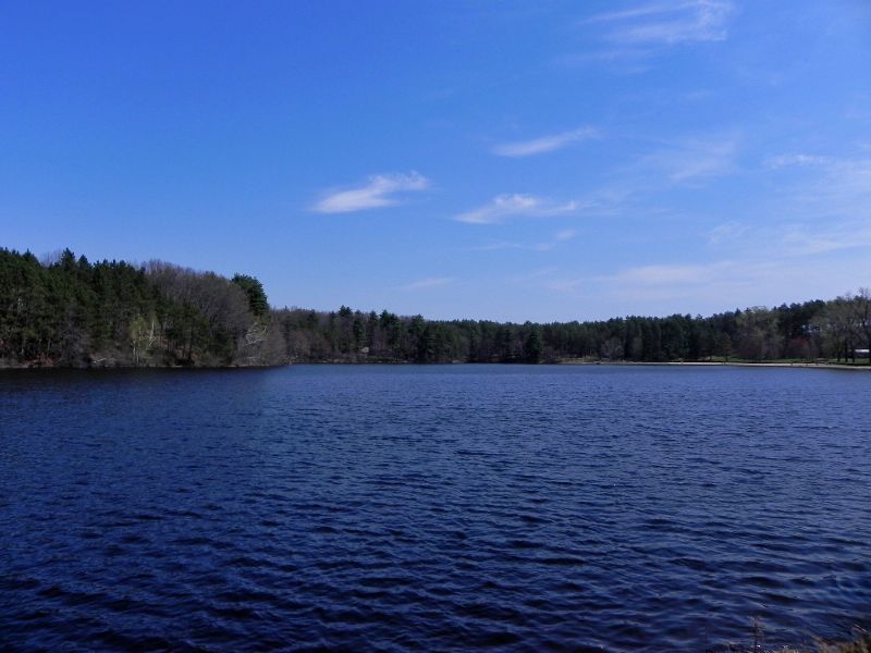
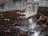
It's a spillway and small house thing that's locked. A nice afternoon walk!
|
|
|
Type: Building, Drain (possibly) & Spillway
Status: Active
Accessibility: Spillway=Easy. Draining here=Difficult.
Recommendation: check it out if you're nearby
|
|
|
Address
570 Burnett Rd
Chicopee, Massachusetts
United States
Owner: City of Chicopee
|
|
|
|
|
The spillway itself is interesting, but for those who like underground stuff, there looks to be some drain access for those who are into it down at the bottom of the spillway. It seems interesting, perhaps someone who's more adventurous would look more into it and see what's to be found!
Also, if you follow the nature trail around it takes you right by westover air force base for some interesting viewing. There;s a boarded up building nearby the fence as well.
|
|
|
|
|
|
flashlight
breathing mask
gloves
long pants / sleeves
|
|
|
|
http://www.mass.go...s/central/chip.htm
Chicopee State Park, formerly the Cooley Brook Reservoir and Watershed has been developed as a high use active recreation area. The total acreage is 575 acres including a 25 acre pond. Activities include swimming, fishing and picnicking.
|
|
|
|
|
|
|
|
|
|
|
|
|
The moderator rating is a neutral rating of the content quality, photography, and coolness of this location.
This location has not yet been rated by a moderator.
|
|
 This location's validation is current. It was last validated by
Steed on 4/14/2010 12:34 AM.
This location's validation is current. It was last validated by
Steed on 4/14/2010 12:34 AM.
|
|
|
on Apr 14 10 at 0:34, Steed validated this location
on Apr 10 10 at 18:02, Liska made this location public
on Apr 9 10 at 2:58, Opheliaism validated this location
on Apr 9 10 at 0:25, Liska made this location available
on Apr 9 10 at 0:24, Liska added some pictures to a gallery
on Apr 9 10 at 0:22, Liska updated gallery Lunch time Walk
on Apr 9 10 at 0:22, Liska created a new gallery
on Apr 9 10 at 0:22, Liska updated the main picture
on Apr 9 10 at 0:21, Liska changed the following: Notes for Mods, Owner, Type, Street Address, City, Province / State (please use full name), Country, History, Status, Accessibility, Hazards, Interesting Features, Recommendation, Security Measures, Required Equipment, Media Coverage, Future Plans, Description, Web Links
|
|
|
|
|
|
|
Is this location inappropriate / broken / missing key info?
If it's something you can fix, please scroll up and click the EDIT button.
If this location was only posted a few days ago, give the creator time to work on it.
Please try sending a message directly to the creator of the location. You'll find that info at the top of this page.
Otherwise, ONLY if you've already tried to contact the original creator,: Click here to notify an administrator.
|
|
|
|
All content and images copyright © 2002-2024 UER.CA and respective creators. Graphical Design by Crossfire.
To contact webmaster, or click to email with problems or other questions about this site:
UER CONTACT
View Terms of Service |
View Privacy Policy |
Server colocation provided by Beanfield
This page was generated for you in 171 milliseconds. Since June 23, 2002, a total of 739221909 pages have been generated.
|
|