|
|
|
UER Store
|
|
sweet UER decals:

|
|
|
|
Activity
|
|
650 online
Server Time:
2024-04-23 21:37:18
|
|
|
 |
|
|
|
|
Location DB >
United States >
California >
Mojave National Preserve >
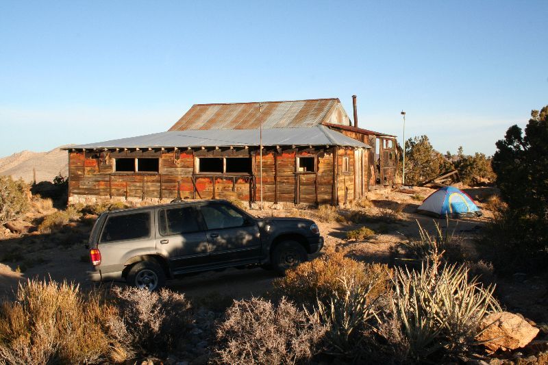
Riley's Camp
|
|
Log in to activate viewing options
|
|
|
created by robk700
on 12/29/2009 1:00 AM
last modified by robk700
on 1/15/2010 2:52 AM
|
|
 |
Publically Viewable |
|
This location has been labeled by its creator as Public, and therefore can be viewed by anyone.
|
|
|
|
|
|
|
|
Type: Outdoors
Status: Abandoned
Accessibility: Moderate
Recommendation: drop everything - must see
|
|
|
|
asbestos
rust
unsafe flooring
flooding
water
air quality
general mine hazards
|
|
|
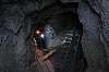
Gold Mines
Ruins
Cold Storage
|
|
|
barbed wire
razor wire
welded doors
|
|
|
|
flashlight
high clearance vehicle
|
|
|
|
Between the Striped and Ivanpah mountains, in the Mojave National Preserve, lies a valley rich in history. The first non native visitors were the Spanish who left messages in secret code carved into the rocks. After WWI, many wounded soldiers fled to this isolated region, seeking greater health. Riley built is cabin here and began extensive mining operations. He was joined by many other ranchers and fellow gold seekers. Riley died in 1984 but a small community lived and worked the land until the formation of the Preserve in 1991. At this time the remaining population was forced to leave. 5 miles north, at Kokoweef, a similar community found a loophole and legally retained their land. Today, they seek for a long lost "river of gold". But that's another story.
|
|
|
|
|
|
|
|
|
|
|
|
|
The moderator rating is a neutral rating of the content quality, photography, and coolness of this location.
This location has not yet been rated by a moderator.
|
|
 This location's validation is current. It was last validated by
Opheliaism on 1/15/2010 11:50 PM.
This location's validation is current. It was last validated by
Opheliaism on 1/15/2010 11:50 PM.
|
|
|
on Jan 15 10 at 23:50, Opheliaism validated this location
on Jan 15 10 at 2:52, robk700 changed the following: Accessibility, Interesting Features, Required Equipment
on Jan 7 10 at 13:41, Opheliaism validated this location
on Jan 7 10 at 13:14, robk700 made this location public
on Dec 29 09 at 4:33, Steed validated this location
on Dec 29 09 at 1:55, robk700 made this location available
on Dec 29 09 at 1:55, robk700 changed the following: Display Name, Notes for Mods, Owner, Type, City, Province / State (please use full name), Country, Latitude, Longitude, Co-ordinate Accuracy, Prefer Satellite, History, Year Built, Year Closed, Status, Accessibility, Hazards, Interesting Features, Recommendation, Security Measures, Required Equipment, Recommended Equipment, Media Coverage, Future Plans, Description, Web Links
on Dec 29 09 at 1:06, robk700 updated gallery 2009
on Dec 29 09 at 1:05, robk700 added some pictures to a gallery
on Dec 29 09 at 1:03, robk700 added some pictures to a gallery
|
|
|
|
|
|
|
Is this location inappropriate / broken / missing key info?
If it's something you can fix, please scroll up and click the EDIT button.
If this location was only posted a few days ago, give the creator time to work on it.
Please try sending a message directly to the creator of the location. You'll find that info at the top of this page.
Otherwise, ONLY if you've already tried to contact the original creator,: Click here to notify an administrator.
|
|
|
|
All content and images copyright © 2002-2024 UER.CA and respective creators. Graphical Design by Crossfire.
To contact webmaster, or click to email with problems or other questions about this site:
UER CONTACT
View Terms of Service |
View Privacy Policy |
Server colocation provided by Beanfield
This page was generated for you in 406 milliseconds. Since June 23, 2002, a total of 738834453 pages have been generated.
|
|