|
|
|
|
|
Location DB >
United States >
California >
South Bay >
Dumbarton Rail Corridor
|
|
Log in to activate viewing options
|
|
|
created by rapcw
on 12/29/2006 10:36 AM
last modified by rapcw
on 4/15/2007 10:04 PM
|
|
 |
Publically Viewable |
|
This location has been labeled by its creator as Public, and therefore can be viewed by anyone.
|
|
|
|
|
|
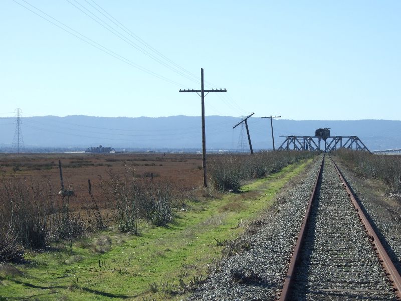
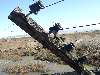
An 11 mile long abandoned (for now) railroad right-of-way which crosses the San Francisco Bay in the south and consists of two swing bridges.
|
|
|
Type: Outdoors
Status: Closed
Accessibility: Easy to see Newark Slough Bridge; Difficult to stand on either swing bridge
Recommendation: check it out if you're nearby
|
|
|
|
rust
unsafe flooring
water
|
|
|
The old signal poles along the right-of-way, both swing bridges, the marshes, the 1.5 mile walk towards the Newark Slough bridge.
|
|
|
None, atleast until they begin refitting it for future passenger rail use; I guess you could say water since it prevents you from walking on both bridges
|
|
|
|
binoculars
long pants / sleeves
towelettes
Rope, inflatable raft to access either bridge or the island between them
|
|
|
Camera, food, good hiking shoes
|
|
|
The Dumbarton Railroad Corridor was constructed by the Central Pacific Railway (Southern Pacific) to eliminate 22.5 miles of trip length from San Francisco to Tracy and opened for service on September 12, 1910. It was the first bridge across the San Francisco Bay, from Redwood City east to Newark, and required two swing bridges, one across Newark Slough and one across the Bay, and six 180-ft long steel trusses. The main use of the line was for quickly delivering freight traffic from the Port of San Francisco east across the Bay. However, the development of the Port of Oakland, the Benecia Rail Bridge, and the decline in rail traffic after WWII led to the reduction and eventual end of rail traffic over the bridge. Southern Pacific started a rehabilitation of the corridor in the 1960s, but the decline of traffic from the Port of San Francisco at the same time led to a halt in the rehabilitation work. The last train crossed the corridor in 1982 and the bridges were permanently placed in the "open" position. In 1994, the San Mateo County Transportation Authority purchased the Dumbarton Rail Corridor right-of-way for future transportation purposes with help from Caltrans. By 2012 Caltrain hopes to have the rail corridor once again active for passenger rail service, most likely without the 100 year old swing bridges still in place along the route.
|
|
|
|
|
The Corridor is planned to be back in use for passenger rail by 2012 at a cost of atleast $590 million.
|
|
|
|
|
|
|
|
|
|
The moderator rating is a neutral rating of the content quality, photography, and coolness of this location.
| Category |
Rating |
| Photography |
7 / 10 |
| Coolness |
8 / 10 |
| Content Quality |
10 / 10 |
|
|
 This location's validation is current. It was last validated by
Emperor Wang on 4/16/2007 3:51 AM.
This location's validation is current. It was last validated by
Emperor Wang on 4/16/2007 3:51 AM.
|
|
|
on Apr 16 07 at 3:51, Emperor Wang validated this location
on Apr 15 07 at 22:04, rapcw changed the following: Web Links
on Apr 15 07 at 22:03, rapcw changed the following: Web Links
on Dec 31 06 at 15:42, Emperor Wang validated this location
on Dec 31 06 at 5:47, rapcw changed the following: Media Coverage, Web Links
on Dec 31 06 at 5:38, rapcw updated gallery picture 1986
on Dec 31 06 at 5:29, rapcw updated gallery picture 1985
on Dec 31 06 at 5:24, rapcw updated gallery picture 1995
on Dec 31 06 at 5:21, rapcw updated gallery picture 1975
on Dec 31 06 at 5:13, rapcw added some pictures to a gallery
|
|
|
|
|
|
|
Is this location inappropriate / broken / missing key info?
If it's something you can fix, please scroll up and click the EDIT button.
If this location was only posted a few days ago, give the creator time to work on it.
Please try sending a message directly to the creator of the location. You'll find that info at the top of this page.
Otherwise, ONLY if you've already tried to contact the original creator,: Click here to notify an administrator.
|
|
|

 order your copy of Access All Areas today!