|
|
|
UER Store
|
|
 order your copy of Access All Areas today!
|
|
|
 |
|
|
|
|
Location DB >
United States >
Colorado >
Colorado Springs >
Wooten
|
|
Log in to activate viewing options
|
|
|
created by Anonymous
on 5/12/2006 7:12 AM
last modified by Anonymous
on 12/22/2023 6:08 AM
|
|
 |
Publically Viewable |
|
This location has been labeled by its creator as Public, and therefore can be viewed by anyone.
|
|
|
|
|
|
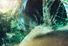
It’s a twin set of 5 and a half foot RCPS that turn 45 degrees and then 90 degrees, as seen on map. One grate to the surface and one manhole per pipe. One of the RCPs has the 2-foot outfall of the parking-lots' drains. Other than that, rather mundane...
In the year 2001, the Silver Creek development crashed their drains into one of the tunnels, adding water and trash to the system. When I moved away from Colorado Springs, it along with the buildings were still being built, and there was a guard. I spotted him from across the creek a couple of times on re-entry missions (both were aborted due to guard presence) thus I never entered again since Thanksgiving Day in year 2000.
My advice for this location: Just enter when its dry and late at night...
|
|
|
Type: Drain
Status: Active
Accessibility: Beyond easy
Recommendation: not very exciting
|
|
|
Address
Sand Creek - West Branch, just south of Platte Ave
Colorado Springs, Colorado
United States
Owner: City Of Colorado Springs - Streets Division
See a map of this location
|
|
|
flooding
water
near a business park, possible rent-a-pig and security cameras on buildings
|
|
|
Very little graffiti in RCPs, a grate, a shape change to RCT (under Platte Avenue).
|
|
|
unstable rocks near outfall
|
|
|
|
|
|
Nice, grippy tennis shoes...
|
|
|
This set of drains was built in the late 1990s in anticipation of an office park complex, Silver Creek. It drains a set of bridges under Platte (Buried Creek) as well as the roof / parking lots of Silver Creek.
|
|
|
|
|
|
|
|
|
|
|
|
|
The moderator rating is a neutral rating of the content quality, photography, and coolness of this location.
This location has not yet been rated by a moderator.
|
|
 This location's validation is current. It was last validated by
Emperor Wang on 12/22/2023 6:08 AM.
This location's validation is current. It was last validated by
Emperor Wang on 12/22/2023 6:08 AM.
|
|
|
on Dec 22 23 at 6:08, Anonymous validated this location
on Dec 22 23 at 6:08, Anonymous changed the following: History, Accessibility, Hazards, Interesting Features, Security Measures, Recommended Equipment, Future Plans, Description
on Aug 4 06 at 14:12, Anonymous validated this location
on Aug 3 06 at 23:57, Anonymous updated the main picture
on Aug 3 06 at 23:56, Anonymous updated the main picture
on Aug 3 06 at 23:55, Anonymous updated gallery picture Outfall.jpg
on Aug 3 06 at 23:53, Anonymous updated gallery picture Debris2.jpg
on Aug 3 06 at 23:52, Anonymous updated gallery picture Debris.jpg
on Aug 3 06 at 23:50, Anonymous added some pictures to a gallery
on Aug 3 06 at 23:49, Anonymous updated gallery Draining: 7/3-7/4/2006
|
|
|
|
|
|
|
Is this location inappropriate / broken / missing key info?
If it's something you can fix, please scroll up and click the EDIT button.
If this location was only posted a few days ago, give the creator time to work on it.
Please try sending a message directly to the creator of the location. You'll find that info at the top of this page.
Otherwise, ONLY if you've already tried to contact the original creator,: Click here to notify an administrator.
|
|
|
|
All content and images copyright © 2002-2024 UER.CA and respective creators. Graphical Design by Crossfire.
To contact webmaster, or click to email with problems or other questions about this site:
UER CONTACT
View Terms of Service |
View Privacy Policy |
Server colocation provided by Beanfield
This page was generated for you in 234 milliseconds. Since June 23, 2002, a total of 740623399 pages have been generated.
|
|