Saw this on Google Maps and had to burn off energy before an interview. I haven't worked out since I left the Army and fucked up and followed the wrong trail hiking in. The blue dot is where I realized I fucked up. Anyone have better information on it, best I can tell they shut it down in 2000. Though the powers still on and the batteries looked pretty new. Apologies about the pictures, I still haven't upgraded my phone and don't have a good camera.
post by Radio2600 | | Re: Mt Almagre South <Reply # 1 on 10/1/2020 6:34 AM >
My old stomping grounds.
My last time up there I'd say was 1987 although I remember I was with my first wife and it was the first time I ever heard Bronski Beat and on the radio no less.
That site looks to be an AT&T Long Lines site, but it doesn't show on the Long Lines map for Colorado. That's not a big deal, because it still could have been used for a microwave link over to Cripple Creek and Victor from Colorado Springs.
Contrary to popular belief, the commo lines for NORAD don't come out from underground on top of Cheyenne Mountain. They come out from underground by Cripple Creek.
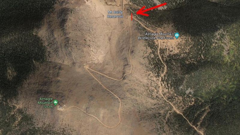
Back to my trip. On Gold Camp Road, there was place marked on the USGS map (IIRC) as Rosemont. The road you see on the satellite image below, leading to the top of Almagre South, came off Gold Camp Road at Rosemont. At that time, the road was in OK shape it was easily traversed with a 2WD vehicle.
The problem with driving all the way to the summit at that was, there was a gate by Mt. Baldy Reservoir (marked on the picture with the arrow pointing at it). The gate was constructed in such a way that spikes protruded from the gate so that if you tried to ram the gate, the spikes would puncture your radiator.
At that time, Mt. Baldy Reservoir was full of water. I see that is not presently the case. That reservoir is (or was) part of the Colorado Springs water supply. They supposedly patrol that, but who knows?