

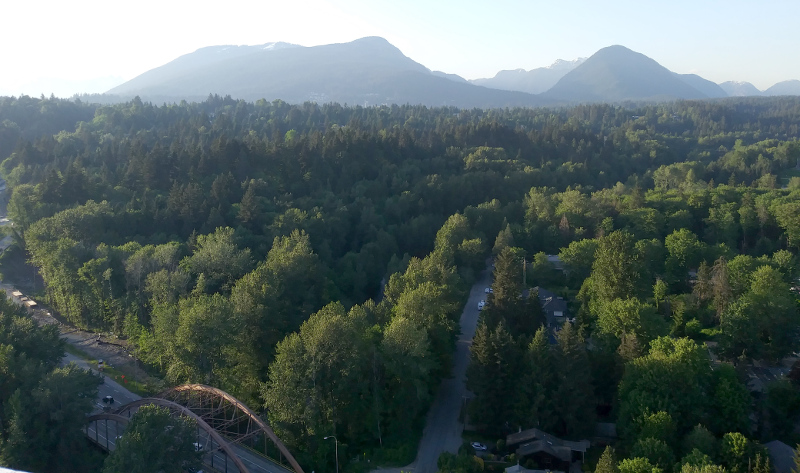
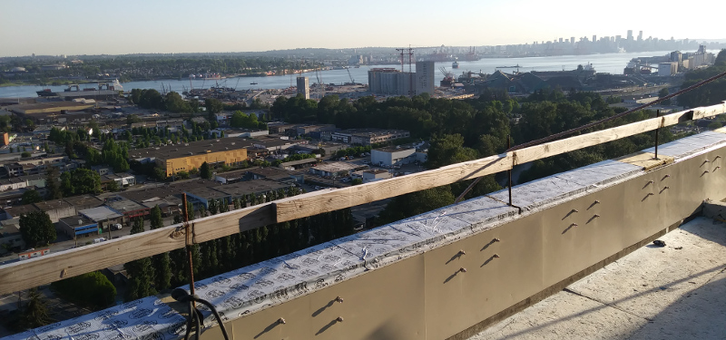
| Posted by billgeorge One evening after a concert, before heading home, I scoped out a nearby condo under construction. To my surprised delight, the security fencing had a big welcoming gap in it, and the building had a big welcoming opening in one wall. I entered, found the stairwell, and climbed up twenty flights, the concert program still clutched in my hand. Even a twenty-storey building feels pretty tall when it is the tallest thing around. Looking north towards downtown, with the junction of Main, Broadway, and Kingsway at my feet: https://3.bp.blogs.../rizeindpndt01.jpg There were a dozen trees planted on the roof, obstructing the various views. Nevertheless it was a balmy night, and I drank it in. |
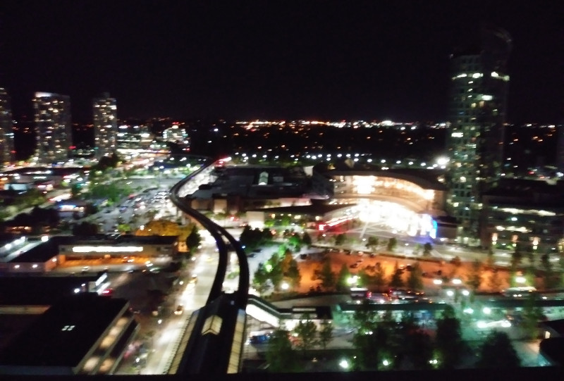


| Posted by billgeorge There were a dozen trees planted on the roof, obstructing the various views. |


| Vancouver's Still Creek Watershed Streams of Dreams Murals "Still a Creek Under the Street" Today, Still Creek is channeled through a pipe underground for two kilometers beginning at its headwaters near Central Park in Burnaby and finally making its first appearance near the 29th Avenue Skytrain station beside Renfrew ravine. It then passes through a culvert under 22nd Avenue and emerges again beside Renfrew Park Community Centre where it is contained by stonework retaining walls. Still Creek continues eastward, partially hidden in culverts, to Burnaby. There it flows above ground until it empties into Burnaby Lake. The lake drains into the Brunette River, which feeds into the Fraser River which flows out into the Georgia Straight. Still Creek drains about 2,400 acres of East Vancouver and much of the western portion of Burnaby between Kingsway and Hastings Street. Nearly 2000 Dreamfish on four Still Creek Stream of Dreams Murals remind us that rain falling into the Still Creek watershed flows to the greatest salmon river in the world—the Fraser River. Children from Norquay, Nootka, Renfrew, and Thunderbird Elementary Schools painted the Dreamfish for Still Creek and share a vision of hope for this partially lost waterway. |


| Posted by billgeorge Sometimes I use an app to track the distance I walk or bike; sometimes I find the map of the finished route rather satisfying. |

| According to your maps, if you hadn't turned around, do you know where/how far you could conceivably go underground? |
| This thread is currently Public. Anyone, including search engines, may see it. |