Hello, this is my first post here on UER. It seems to be the best site, and I figured I would finally share after years of URBEX on my own. The first place I would like to share, and one that I am most proud of, is Hunter's Point Naval Shipyard. I mention where these pictures come from simply because it's so iconic to the city yet rather difficult to gain access to completely. These pictures I took back in 2013, and some of them will be popping up on google earth this month, also. Many of these buildings are quite dangerous to enter due to radioactive and toxic contamination that is still present. The site is broken into parcels from A-E, with A being largely turned over and E still having some bad radiological and toxic contamination. While it can be extremely low for skin dose exposure, the chance for inhalation contamination is possible, so if you do go and enter buildings, make sure you bring an organic-rated particulate mask. Watch out for the roving guards! I hope you enjoy!
1. The old crow's nest used for measuring EMF flux from the radar testing building across the alley.
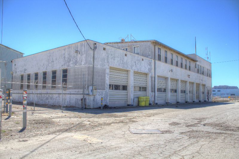
2. The fire department building, which was co-located with the police building.
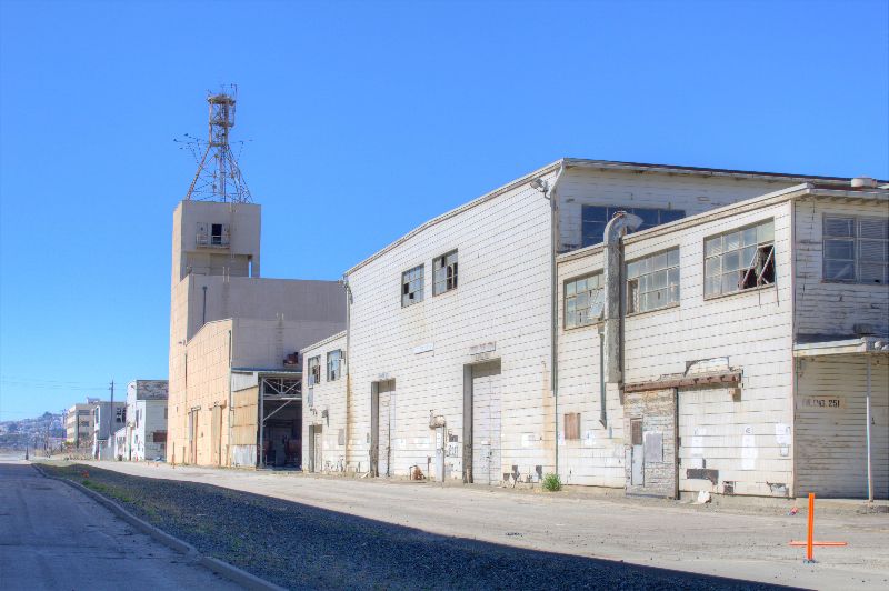
3. One of the pump houses in between the two graving docks. There is a pipe below this pump house that is sealed and still contains radioactive byproducts from the operation Crossroads vessels that were decontaminated (or they attempted to decontaminate) here.
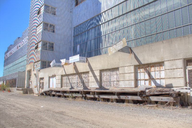
4. The inside of an old machinery factory floor.

5. A machining shop, which still had contaminated metal turnings on the ground and was fenced off.
6. Looking from the opposite side of the graving dock at the pump house in #3 above.
7. This is a powerful one. This is where most of the NRDL (Naval Radiological Defense Laboratory, some internal documents say "Development" instead of defense) buildings were located. They are torn down now, but that demolition loosed many toxic and possibly contaminated particles into the ground. Unfortunately I did not have proper clothing nor my ion chamber and dosimeter to go test, or I would have seen just how high above background radiation it is there.
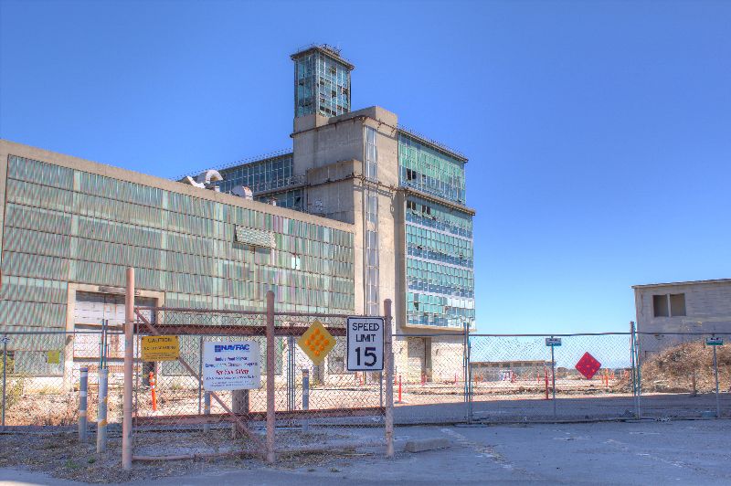
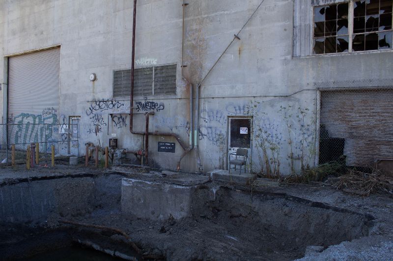
8. The big blue factory, viewable from 101. This area is very tightly controlled now due to excavation around it, falling glass, and the fact there are floors giving way. A few old pictures by the company that is doing the remediation, tetra tek, show what is inside, which are still some machine components and other radio equipment.
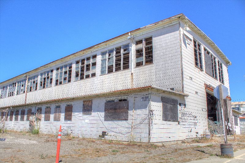
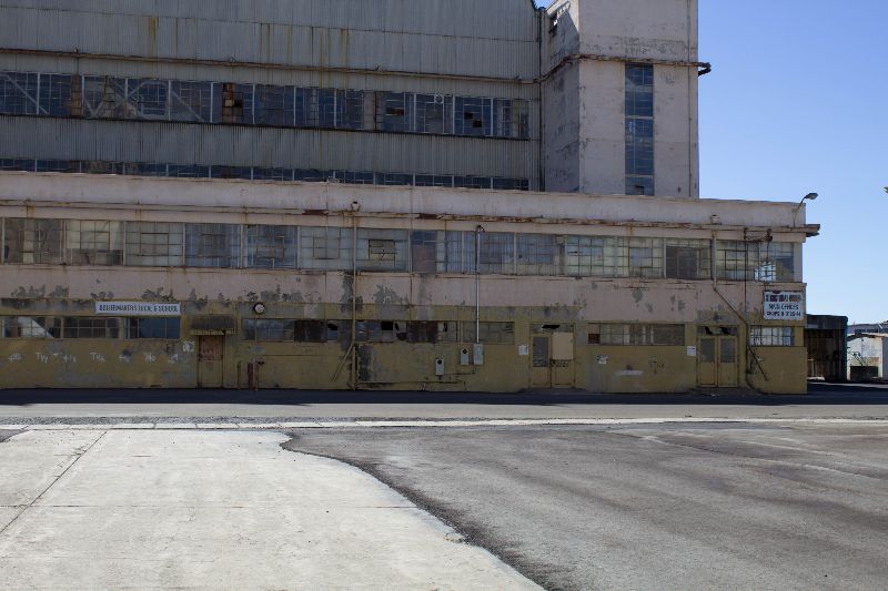
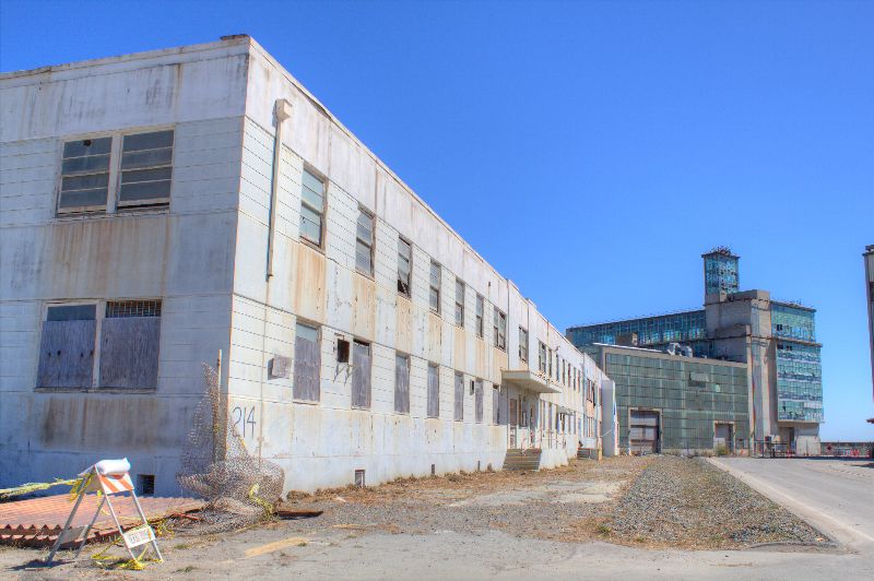
9. Boilermaker Local 6 School - where the shipbuilders trained their own.
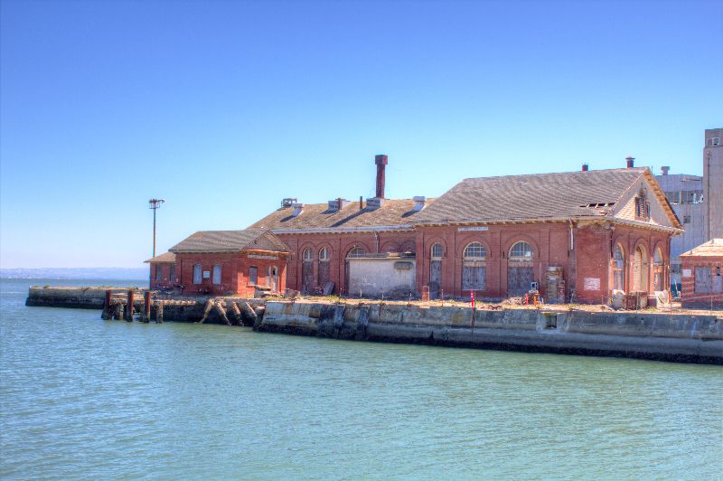
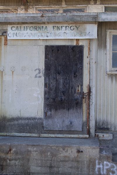
10. This was over near the sub pens at the north part of the base. From what I can tell, this company worked with insulation. I'm guessing it was one of the places rented out when the base largely ceased ship work.
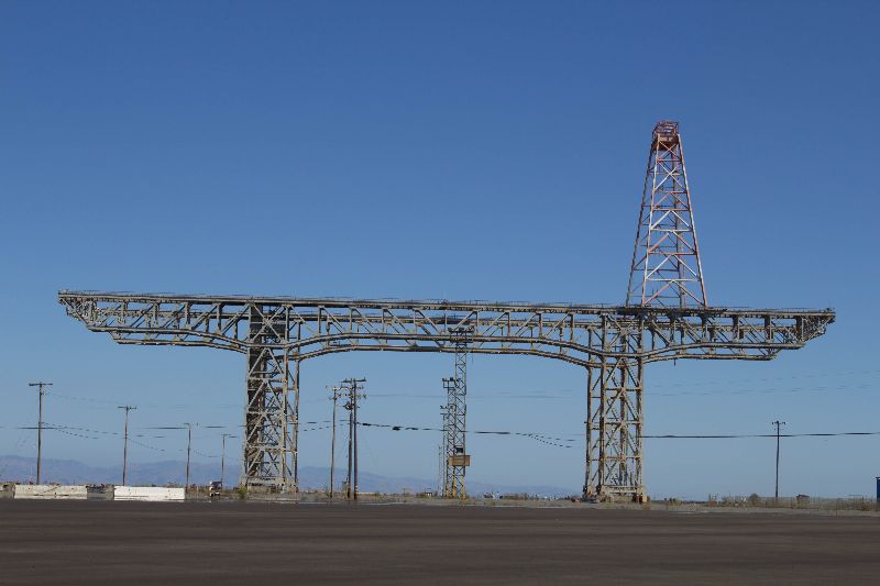
11. The gun mole pier crane. This monstrous crane which might still be rated as the strongest in the world, used to lift battleship turrets and even moire amazingly, "Catch" polaris missiles in flight so they could have their engines examined. They also decontaminated a B-17 on this pier, along with other pieces of equipment during the golden age of atomic development. It is easily visible from most places in the bay area.
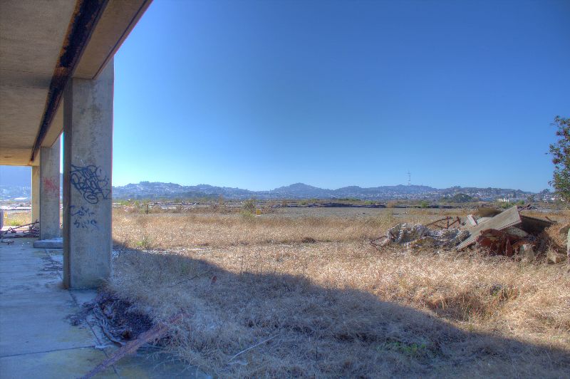
12. The North side of the enlisted barracks looking east. What it is looking over is a huge toxic dump, where they buried not only chemicals but radium paint and equipment, and potentially items from contaminated vessels.
13. This is why I love urbex - the thought of how busy and full this area must have been just makes the imagine run wild. This is the main line in the middle of the base, behind one of the two huge factory floors, where metal deposits were collected to be melted down and re-used, or disposed of.
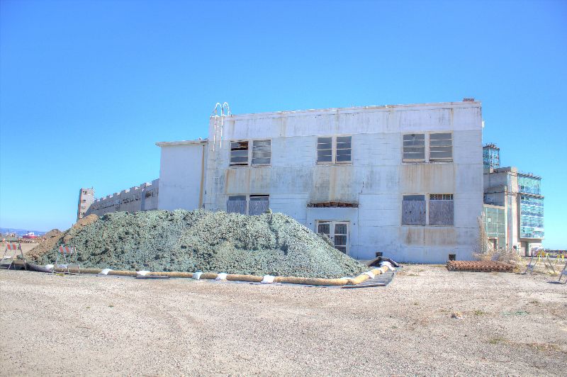
14. This is the front side of the NRDL health physics building, in proximity to the Blue Factory. I recently remember seeing this building in a movie, although I can't remember what it was.
15. The side of the NRDL health physics laboratory, showing the caches of toxic or potentially contaminated earth. The blue stuff on the soil is a rubbery substance that keeps it from blowing away in the wind. There are (or were, then) huge piles of this soil over on parcel E, just east of the enlisted barracks.
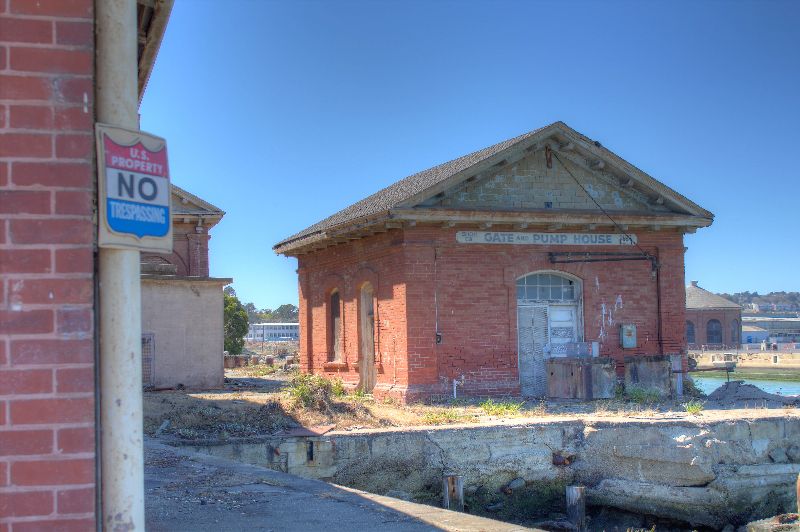
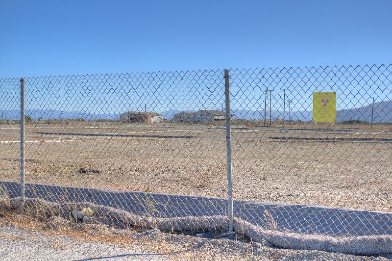
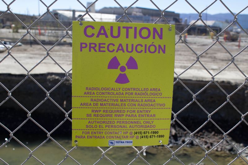
16. You'll see this everywhere. This is no joke, especially on the barges that are parked behind a few of these. Wear your mask!
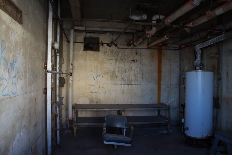
17. "Room 25" which actually shows up on some maps and documents. I took this picture by holding the camera up over a gap in the wall, and was pretty surprised at how well it came out.
18. A large reclamation pit they had scooped out. The dirt pile was right behind me. I was amused at the chair sitting there on the precipice. You could find piles of embedded pipes all around, where fluids and gases had flowed back and forth across the base, some toxic, some benign.
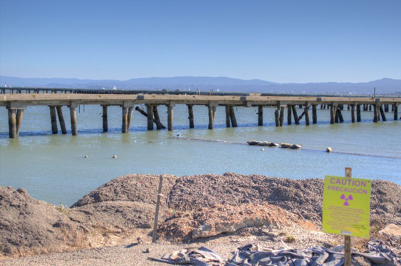
19. Those seals were buttheads and wouldn't hold still. I had to take HDR shots here due to the ridiculous contrast in the area, and the fact I had to move fairly fast. This area is called the "metal reef" area and it is right near their main pier. Seals love this area since there is no one around to bother them. Right near this point is a boat someone randomly beached, and right behind it are the piles of toxic sand. I wonder if any of these seals are facing health problems from all the stuff in the water?
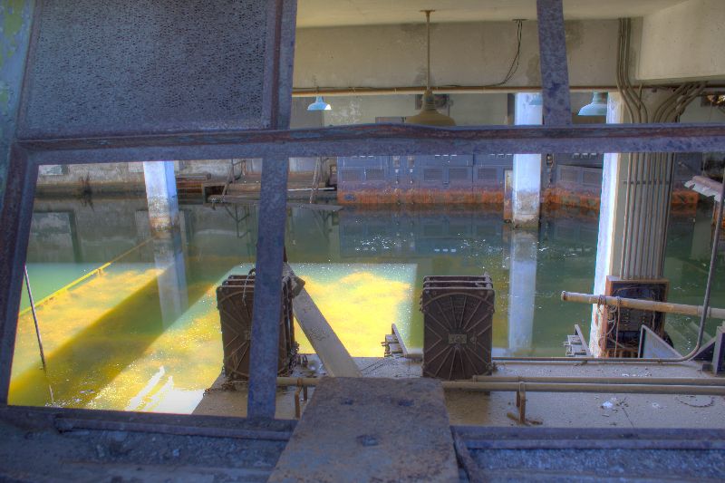
20. An old battery substation that was in between the graving docks. You can see some of the electrical machinery submerged in the water of the bay that has flooded in.
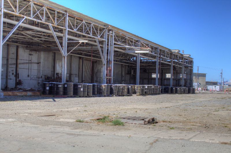
21. Barrels of uncategorized waste, most of them water mixed with other chemicals. That area right behind the barrels was a processing facility for chemicals such as mercury and lead, so use your imagination!
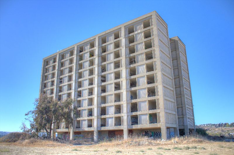
22. This is the enlisted barracks. The tragedy of this is that it is located right next to what is probably the most toxic location on the base. It's a closed off area, where they used to simply dump everything. It has a nice view of the (formerly) candlestick point, but it is simply too dangerous to develop or use.
I hope that you have enjoyed the trip. I did, as it was the first time I started photographing my trips. I have quite a few more photos from this, but they are inaccessible at home right now. I have a few more trips that warrant photo posts, and I will get to them later. I hope that you enjoy, and please let me know via message (or post!) if I did anything incorrect or a violation of the rules in the rookie documentation in this first post (such as setting it publically viewable - since I made it that way on flickr and some of these photos are on google earth at the end of the month, I figured that was best!)


 .
.