![]()
The underground power station.
 This
is one of the freakiest places I have ever been to for a number of reasons.
Most important of these is the made in hell road system that takes a day and
a half to get to this power station. The mainstream highways and motorways
to the nearest town to this power station are pretty good, state of the art
four and six laned motorways. But once you are off the main motorway, the
roads get bad. The road that lead me most of the way to the power station
was called a highway, I would never call it that. It was narrow, windy and
in poor condition. Then I hit the so called tourist road that lead the final
eight kilometers to the power station entrance. It was the most scary road
I have ever driven on. Six kilometers of very windy, very steep road with
hairpin bends, blind corners, narrow road, few safety barriers, little warning
signs of sharp corners, corners where the road is sloped almost 45 degrees
into the curve. I had to keep my foot on the brakes almost all the way down
the hill. By the time I pulled into the car park I could smell the hot metal
of the brakes.
This
is one of the freakiest places I have ever been to for a number of reasons.
Most important of these is the made in hell road system that takes a day and
a half to get to this power station. The mainstream highways and motorways
to the nearest town to this power station are pretty good, state of the art
four and six laned motorways. But once you are off the main motorway, the
roads get bad. The road that lead me most of the way to the power station
was called a highway, I would never call it that. It was narrow, windy and
in poor condition. Then I hit the so called tourist road that lead the final
eight kilometers to the power station entrance. It was the most scary road
I have ever driven on. Six kilometers of very windy, very steep road with
hairpin bends, blind corners, narrow road, few safety barriers, little warning
signs of sharp corners, corners where the road is sloped almost 45 degrees
into the curve. I had to keep my foot on the brakes almost all the way down
the hill. By the time I pulled into the car park I could smell the hot metal
of the brakes.
A few minutes after I arrived a car pulled in with smoke pouring from it's brakes. I heard that almost every year cars go off the road from brake failures. The tourist pamphlets mentioned none of this.
But, it was (possibly) worth it.
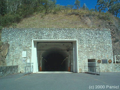
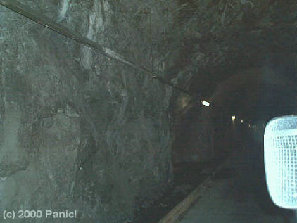
Entrance to the power station is like a big hole in the mountain side
The entrance can be used to drive down to the power station
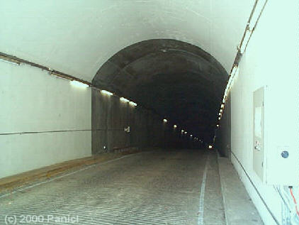
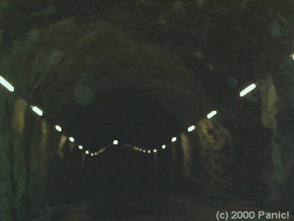
Looking down the entrance tunnel I could just see the headlights of a car some 1 km away.
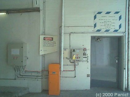
Stuff just inside the tunnel entrance included emergency equipment
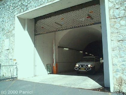
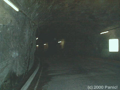
Driving down the tunnel
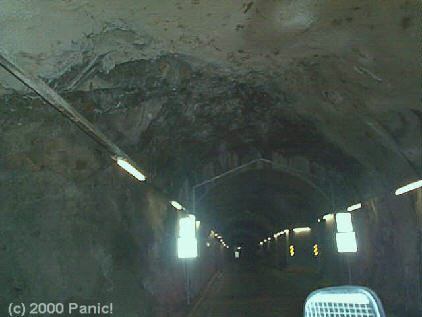
signs in the tunnel with a branch to the right further on
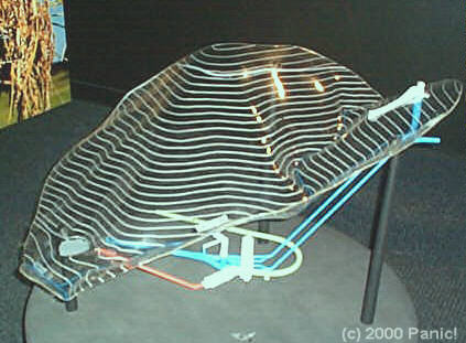
This is a very
important picture, as it helps give a sense of scale to this all. It is a
scale model of the power station. The power station itself is 240 metres below
the ground, represented by the clear plastic and contour lines. On the lower
middle is a representation of the power station under the ground.
The yellow tube that curves around to the white things is the underground
road down to the power station. The main turbine hall is the larger white
section while the smaller white section attached to its' lower end is a control
area. The orange tube leading from the control area is an escape passage that
contains 660 steps. The blue pipes are water pipes, each about 7 metres wide.
On the right is
the inflow pipe, with an overflow stack. Remember this.
The white thing on top of the overflow stack is an overflow outlet.

Looking out over
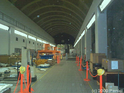
the main power hall with its' 4 main generators.
Most of the generators and the turbines are below this floor. Note the shipping
containers for scale.

Main control room. Most of the control of the power station is done remotely from a town about 150 km away.
Top of generator number 8 (generators 1-4 are at another power station)
Looking down the main power hall. Remember, this is 240 metres below the ground.
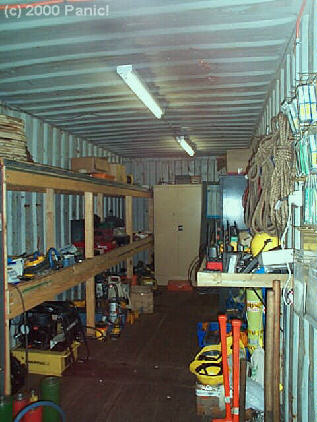
Ohh just look at all that cool equipment. Hard hats, rope, flashlights, spotlights, radios and more.
Looking down 3 levels to the turbine rooms below the generator hall
This may not look much, but it is an opened up generator casing.

There are two 20 tonnes cranes in the top of the power hall.
Looking back down the power hall. Note the bare rock walls on the right and the control room at the far end.
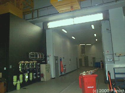
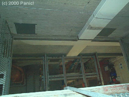
Looking through to the control section tunnel. Note the emergency equipment on the wall to the left.
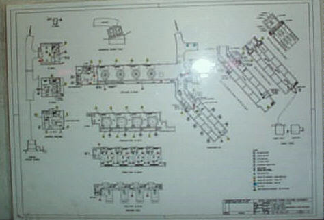
Extensive floor plan of the power station. Note the access tunnel shown on the left curves back around to the main power hall. The top of the curve however is not depicted on this plan. Note also the emergency exit stair on the right, shown by a line leading from the control area to a small square room.
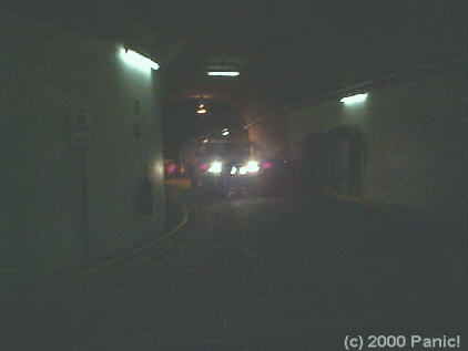
Car entering the main tunnel, sorry the picture is a little washed out due to darkness.
Walking back up the tunnel to the car park.
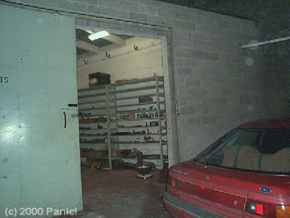
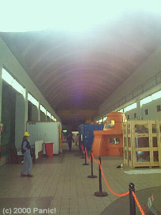
Underground tool room and car park
Looking right up the main tunnel to the entrance just visible a kilometer away.
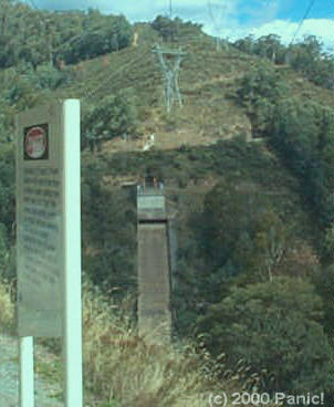
Remember that
model of the power station? This is the overflow stack shown on the right.
You could hear the water rushing through it even from here. Water drops over
200 meters from within this down to the power station under the ground.
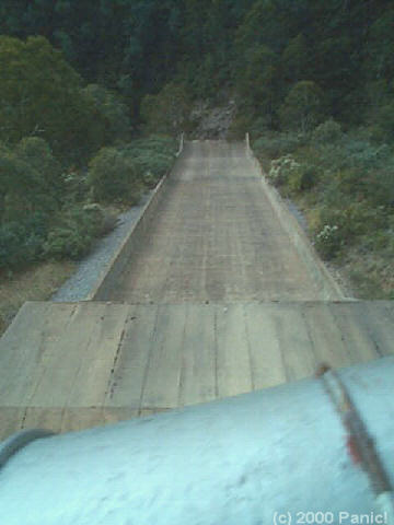
This ramp is STEEP!

This is the top of the overflow stack

Even though I climbed into here, I forgot to lift this hatch, oh well, too late now.
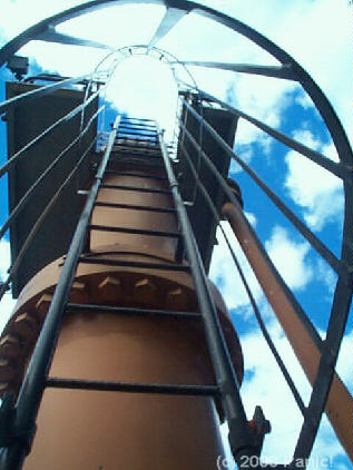
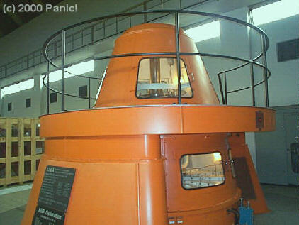
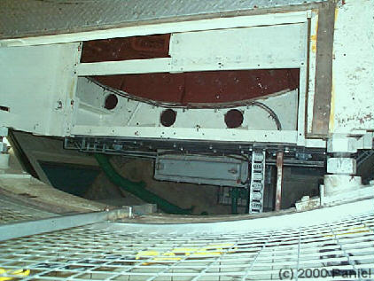
These things are the tops of giant valves used to control water flow. I think.
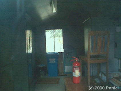
Small support shack.

That's the overflow ramp down there. It drops away at least a 70 degree angle.
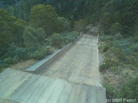
That is really steep. The camera is pointing almost vertically down. Note the angle of the trees to the ramp. At the bottom, about 150 metres below is a rock strewn creek.
The ideal spot for parachute roller blading or skating. There's be no other way you could stop yourself. To take this photo was really scary hanging off a wire fence to get the view.
![]()
![]()
|
|
Best
Viewed at
|
|
| About this site |
 |
©Copyright
notice
© This entire site is copyrighted 1997 - 2006. No image or text may be reproduced, edited, copied, stored in any off-line storage device, or placed on any another website at any time, without written permission from Panic!, web site owner. |
|
