|
|
|
UER Store
|
|
 order your copy of Access All Areas today!
|
|
|
 |
|
|
|
|
Location DB >
Cambodia >
Kampot Province >
Koh Tonsay (Rabbit Island) >
Khmer Rouge Lookout & Bunker
|
|
Khmer Rouge Lookout & Bunker
|
|
|
Log in to activate viewing options
|
|
|
created by Neil T
on 3/19/2011 4:52 PM
last modified by Neil T
on 3/19/2011 5:15 PM
|
|
 |
Publically Viewable |
|
This location has been labeled by its creator as Public, and therefore can be viewed by anyone.
|
|
|
|
|
|
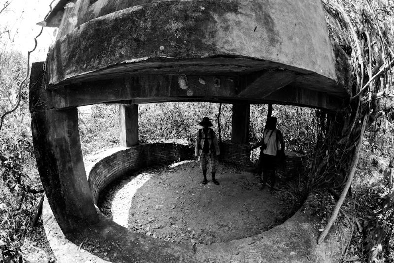
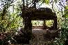
It's just a small abandoned Khmer Rouge bunker and lookout atop a fairly small island that still has no electricity.
|
|
|
Type: Outdoors
Status: Abandoned
Accessibility: Easy
Recommendation: check it out if you're nearby
|
|
|
Address
Top of the Hill
Koh Tonsay (Rabbit Island), Kampot Province
Cambodia
Owner: Government?
|
|
|
|
|
view from the top of the bunker, wildlife on the jungle walk/hidden in the corners of the bunker
|
|
|
a long hike up a hill, deters fat people
|
|
|
|
|
|
bug repellent, anti-venom
|
|
|
A one-time bunker and lookout for the Khmer Rouge.
|
|
|
|
|
|
|
|
|
|
|
|
|
The moderator rating is a neutral rating of the content quality, photography, and coolness of this location.
This location has not yet been rated by a moderator.
|
|
 This location's validation is current. It was last validated by
Steed on 3/20/2011 1:08 PM.
This location's validation is current. It was last validated by
Steed on 3/20/2011 1:08 PM.
|
|
|
on Mar 20 11 at 13:08, Steed validated this location
on Mar 19 11 at 17:15, Neil T changed the following: Province / State (please use full name)
on Mar 19 11 at 17:12, Neil T made this location available
on Mar 19 11 at 17:10, Neil T changed the following: Web Links
on Mar 19 11 at 17:06, Neil T added some pictures to a gallery
on Mar 19 11 at 17:03, Neil T updated gallery A hike up a hill
on Mar 19 11 at 17:03, Neil T updated gallery A hike up a hill
on Mar 19 11 at 17:02, Neil T created a new gallery
on Mar 19 11 at 17:02, Neil T updated the main picture
on Mar 19 11 at 17:01, Neil T changed the following: Notes for Mods, Owner, Type, Street Address, City, Province / State (please use full name), Country, Latitude, Longitude, Co-ordinate Accuracy, Publically Viewable, History, Status, Accessibility, Hazards, Interesting Features, Recommendation, Security Measures, Recommended Equipment, Media Coverage, Future Plans, Description, Web Links
|
|
|
|
|
|
|
Is this location inappropriate / broken / missing key info?
If it's something you can fix, please scroll up and click the EDIT button.
If this location was only posted a few days ago, give the creator time to work on it.
Please try sending a message directly to the creator of the location. You'll find that info at the top of this page.
Otherwise, ONLY if you've already tried to contact the original creator,: Click here to notify an administrator.
|
|
|
|
All content and images copyright © 2002-2024 UER.CA and respective creators. Graphical Design by Crossfire.
To contact webmaster, or click to email with problems or other questions about this site:
UER CONTACT
View Terms of Service |
View Privacy Policy |
Server colocation provided by Beanfield
This page was generated for you in 140 milliseconds. Since June 23, 2002, a total of 739328883 pages have been generated.
|
|