|
|
|
UER Store
|
|
 order your copy of Access All Areas today!
|
|
|
 |
|
|
|
|
Location DB >
United States >
California >
Death Valley >
Inyo Mine and Camp
|
|
Log in to activate viewing options
|
|
|
created by rapcw
on 4/13/2006 2:11 PM
last modified by fr00tCake
on 4/13/2023 7:32 PM
|
|
 |
Publically Viewable |
|
This location has been labeled by its creator as Public, and therefore can be viewed by anyone.
|
|
|
|
|
|
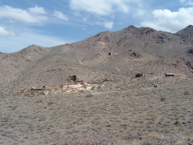
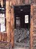
An old gold mining camp with a mill and extensive mines.
|
|
|
Type: Mining Complex
Status: Abandoned
Accessibility: Moderate
Recommendation: check it out if you're nearby
|
|
|
|
rust
unsafe flooring
flooding
air quality
Mine hazards
|
|
|
The mining camp and mill, the ore bin, the extensive open tunnels and shafts.
|
|
|
Difficult canyon road that is 9 miles long
|
|
|
|
flashlight
rope
harness
gloves
head protection
long pants / sleeves
High Clearance or 4WD vehicle
|
|
|
|
In 1904, after the discovery of the Keane Wonder in the Funeral Mountains, hundreds of fortune seekers combed the range to find their own Wonder. In January 1905, two prospectors, Maroni Hicks and Chet Leavitt, did just that when they discovered rich gold-bearing quartz veins in Echo Canyon while chasing their pack animals. By May they had staked 20 claims in the area, and were ready to sell. In December, Chet Leavitt joined up with a group of Mormon friends from Utah to buy out Hicks and form a closed corporation, the Inyo Gold Mining Company, incorporating it with a capitalization of $1,000,000.
Over the next two years the company carried out extensive development work, and it had three shafts driven into the ground by early 1907, one of which contained or worth nearly $300 per ton. At peak seasons the company employed around 30 miners to work the shafts. The camp below the mines boasted in the spring of 1907 a boarding house, sleeping quarters and several tents, a blacksmith shop, and a store selling groceries and mining supplies.
There was good ore in the ground, but the problem was transporting it without first milling it. The main problem was a lack of water to operate the mill, and the company was expecting a nearby water company to bring water close enough to where it would be profitable to build a mill. Because of this no ore was shipped in 1906. Around April 1907 the Inyo Gold company announced it would begin construction of a mill and begin shipping ore upon its completion. But the company had waited too long. In September, the funds advanced by the owning partners ran out, and the company's debt reached over $15,000 and its treasury emptied. To sell a large number of remaining shares, the company decided to go public, right as the great financial panic of 1907 occurred. It faced a depressed market and unavoidable bankruptcy, and mining ceased in December of that year. In January of 1912 the Inyo was finally abandoned, without even shipping a single ton of ore.
The mines lay idle for 23 years, until 1935-36 when the Inyo Consolidated Mining Company leased the claims from a new owner and began working the old tunnels. It revived the camp and installed a 25-ton ball mill and a small amalgamation and concentration plant, run by water brought from Furnace Creek. The company mined and milled ore averaging $25 a ton until lack of funds forced it to close again in 1938. Other small enterprises continued to try their luck at the mines,some with moderate sucess, but by 1941 the mines closed down for good.
|
|
|
|
|
|
|
|
|
|
|
|
|
The moderator rating is a neutral rating of the content quality, photography, and coolness of this location.
This location has not yet been rated by a moderator.
|
|
 This location's validation is current. It was last validated by
Emperor Wang on 4/13/2023 11:59 PM.
This location's validation is current. It was last validated by
Emperor Wang on 4/13/2023 11:59 PM.
|
|
|
on Apr 13 23 at 23:59, Emperor Wang validated this location
on Apr 13 23 at 19:32, fr00tCake changed the following: Latitude, Longitude
on Apr 13 23 at 19:31, fr00tCake changed the following: Latitude, Longitude, Co-ordinate Accuracy, Prefer Satellite
on Dec 27 06 at 3:51, Emperor Wang validated this location
on Dec 27 06 at 3:34, rapcw changed the following: Latitude, Longitude, Co-ordinate Accuracy
on Dec 27 06 at 2:58, rapcw changed the following: Latitude, Longitude, Co-ordinate Accuracy
on Dec 27 06 at 2:51, rapcw changed the following: Latitude, Longitude, Co-ordinate Accuracy
on Dec 27 06 at 2:50, rapcw changed the following: Latitude, Longitude, Co-ordinate Accuracy
on Apr 23 06 at 18:59, Emperor Wang validated this location
on Apr 13 06 at 23:59, rapcw made this location available
|
|
|
|
|
|
|
Is this location inappropriate / broken / missing key info?
If it's something you can fix, please scroll up and click the EDIT button.
If this location was only posted a few days ago, give the creator time to work on it.
Please try sending a message directly to the creator of the location. You'll find that info at the top of this page.
Otherwise, ONLY if you've already tried to contact the original creator,: Click here to notify an administrator.
|
|
|
|
All content and images copyright © 2002-2024 UER.CA and respective creators. Graphical Design by Crossfire.
To contact webmaster, or click to email with problems or other questions about this site:
UER CONTACT
View Terms of Service |
View Privacy Policy |
Server colocation provided by Beanfield
This page was generated for you in 93 milliseconds. Since June 23, 2002, a total of 739042682 pages have been generated.
|
|