|
|
|
UER Store
|
|
 order your copy of Access All Areas today!
|
|
|
|
Activity
|
|
644 online
Server Time:
2024-04-19 22:18:39
|
|
|
 |
|
|
|
|
Location DB >
United States >
Massachusetts >
Nahant >
Fort Ruckman
|
|
Log in to activate viewing options
|
|
|
 |
Publically Viewable |
|
This location has been labeled by its creator as Public, and therefore can be viewed by anyone.
|
|
|
|
|
|
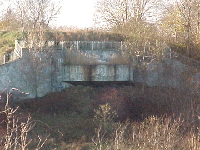
Right off the ocean in Nahant, even if you don't go inside the bunkers the scenery is worth a look, plus there are some old cement wells and some piping that run on the outside of the area
|
|
|
Type: Tunnel
Status: Repurposed
Accessibility: Not Happenin'
Recommendation: forget it
|
|
|
|
rust
flooding
water
air quality
|
|
|
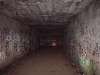
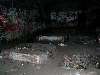
Extensive tunnels, some old relics from when the bunkers were in use
|
|
|
fences
barbed wire
welded doors
cops patrol often
|
|
|
|
flashlight
rope
long pants / sleeves
let someone know that your going in case you can't get out
|
|
|
Camera, Make sure you have plenty of flash lights etc
|
|
|
Fort Ruckman was a U.S. Coast Artillery fort located in Nahant, Massachusetts. Originally called the Nahant Military Reservation, the fort was laid out in 1904-1907 and covered an area of about 45 acres just northwest of Bass Point, on the southwest side of the Nahant peninsula.[1] During the 1920s, this area was renamed in honor of Maj. Gen. John Wilson Ruckman, a former Colonel in the Coast Artillery.[2]
The fort was decommissioned after WW2 and the property was sold to the town and to private owners beginning in about 1947. The fire control tower indicated on the map was used as part of the Army/Lincoln Labs Nike program-related radar research and development during the late 1940s and early 1950s and at one point had a large radar antenna on its roof. A Nike target tracking radar was also erected on Bayley's Hill (the eastern edge of the fort) during the 1950s.
One of the two 12-inch gun positions and a fire control tower (at left) for Battery Gardner at Ft. Ruckman.
A casemated 12-inch gun like that in the emplacement above.
The geodetic disk (PID MY0039) set in the ground above the galleries of Battery Gardner at Fort Ruckman. Its approximate position is marked on the map above.
During WW2, Fort Ruckman housed the Group Command post for the northern district of the harbor defense artillery and Battery Gardner, two 12" guns in east-facing casemates of reinforced concrete. These casemates were built just before WW2 over the open (surface) gun positions originally completed in 1923.[3]
The 12-inch guns were likely the 12-inch M1895, on Model 1917 barbette carriages.[4] When they were installed, these were the largest caliber guns in the harbor defenses. Each gun a total weight of 151 tons and had a maximum range of about 29,300 yards (about 16.6 miles). This would enable the guns, for example, to cover an arc extending from Gloucester in the north to North Sictuate in the south. The centers of the two gun positions are roughly 425 ft. apart.
Today, most of the area within the fort's WW2 boundaries has been converted into residential real estate, recreation, or park land for the Town of Nahant. The extensive concrete galleries between the north and south firing positions which housed fire control activities, ammunition storage, and crew quarters, have been buried under 20 or so feet of earth during the casemate construction process. These subterranean galleries are still accessible and are used by the Town for storage.
On the surface of the buried galleries are a series of large and smaller concrete chimneys that ventilate the galleries below. A geodetic marker, MY0039—RUCKMAN RESET (see photo at left), was emplaced in 1943, likely as a point of reference for aiming the 12" guns.
About 800 ft. NNW of the northernmost gun position of Battery Gardner lay the center of a 3-gun battery of antiaircraft guns known as Location 130-2C, or the Boston Harbor No.4 AAA Battery. The three guns were surface-mounted, standard barbette carriage 3" guns, Model 1917-A2. The gun centers formed a roughly equilateral triangle 150 ft. on a side. The gun positions were constructed in 1934, but were not armed until 1942. Final construction on the battery commenced on May 5, 1942, and was completed in less than a month. Today, the battery positions appear (from Google maps) to have been destroyed, but the center point of the battery would fall roughly at the left field foul pole of the first baseball field southeast of the corner of Castle and Flash Roads.
|
|
|
|
|
The main doors have been excavated and the bunkers are being used as equipment storage by the town of Nahant. There was electricity inside as of a few months ago.
|
|
|
|
|
|
|
|
|
|
The moderator rating is a neutral rating of the content quality, photography, and coolness of this location.
| Category |
Rating |
| Photography |
6 / 10 |
| Coolness |
7 / 10 |
| Content Quality |
7 / 10 |
|
|
 This location's validation is current. It was last validated by
Mike Dijital on 10/5/2014 2:07 PM.
This location's validation is current. It was last validated by
Mike Dijital on 10/5/2014 2:07 PM.
|
|
|
on Oct 5 14 at 14:07, Mike Dijital validated this location
on Oct 5 14 at 14:05, Mike Dijital changed the following: Notes for Mods, Type, Latitude, Longitude, Co-ordinate Accuracy, Prefer Satellite, History, Media Coverage, Web Links
on Oct 5 14 at 13:33, Mike Dijital added some pictures to a gallery
on Oct 5 14 at 13:32, Mike Dijital added some pictures to a gallery
on Oct 5 14 at 13:31, Mike Dijital added some pictures to a gallery
on Oct 5 14 at 13:30, Mike Dijital created a new gallery
on Oct 5 14 at 13:30, Mike Dijital made this location public
on Oct 5 14 at 13:30, Mike Dijital made this location available
on Oct 5 14 at 13:30, Mike Dijital made this location unavailable
on Mar 11 11 at 6:31, Steed validated this location
|
|
|
|
|
|
|
Is this location inappropriate / broken / missing key info?
If it's something you can fix, please scroll up and click the EDIT button.
If this location was only posted a few days ago, give the creator time to work on it.
Please try sending a message directly to the creator of the location. You'll find that info at the top of this page.
Otherwise, ONLY if you've already tried to contact the original creator,: Click here to notify an administrator.
|
|
|
|
All content and images copyright © 2002-2024 UER.CA and respective creators. Graphical Design by Crossfire.
To contact webmaster, or click to email with problems or other questions about this site:
UER CONTACT
View Terms of Service |
View Privacy Policy |
Server colocation provided by Beanfield
This page was generated for you in 156 milliseconds. Since June 23, 2002, a total of 738542021 pages have been generated.
|
|