|
Hi guys, I just got Google Earth on my android phone and was looking around at some of my old explorations. It was really interesting seeing my old haunts from above, but then I remembered places that have burned down and or been demolished.
I got the idea to see if they were still around on Google Earth and was surprised to see that some of them were still around in their decrepit glory, while others were sadly demolished before they'd had a chance to be captured in 3D. So I decided to take screen shots of my locales to keep as mementos of years gone bye.
Has anyone thought about/done things like this?
Bristol Recording: Not long for this world, Demo on the front has already begun.

Risdon Saftey Pin: Gone - Arson

Environmental Waste Recycling: Demolished without my knowledge. This really bummed me out because it was one of the easiest locations to get in to and explore. Despite the heavy contamination.


Softly creeping through
Empty hallways decades old,
glimpsing history. |
|
I have never thought about using the 3D feature to view locations that have been demolished. The plus side to doing that in Toronto is many things are captured in 3D, and many things are demolished!
I do often use Street View to determine whether a location is vacant, or its state of decay.
One day I got a good camera.
https://www.flickr...hotos/fleetsurbex/ |
|
Most of the times on google earth you can rewind the date of the last times they took imaging.
If you want to go back 100 years or so you can use
https://www.historicaerials.com/viewer
|
|
Google earth is actually my main source for scouting locations. I use the historic slider so I can view older pictures so I can get a rough gauge on how long a location has been inactive. It also is updated more often than Google maps so it's more likely to find a building that is still around. It's a phenomenal program
yup |
|
I haven't used it to look back on locations since most are close by or a small drive away. I do use the 3-D to get a good feel for a place before a scout it.
I'm here for a good time not a long time. |
|
This is a cool idea. I've always though this feature of Earth was really neat.
Here are the only two demolished abandonments I've explored that 3D imagery exists for:
Bancroft Mills, destroyed by arson on Election Day, 2016
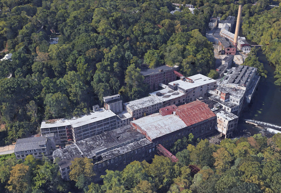
Baltimore Pure Rye, demolished after several fires last summer. The aftermath of one can be seen in the foreground.

Flickr |
|
Ex-Honeywell Location I used to explore in Madison, NJ before it started being knocked down. They left the majestic library in the second picture in tact, but there are now apartments there (and I'm 1000 miles away)
so I can't explore. 
1.

2.

|
|
Posted by Trout na bout
Google earth is actually my main source for scouting locations. I use the historic slider so I can view older pictures so I can get a rough gauge on how long a location has been inactive. It also is updated more often than Google maps so it's more likely to find a building that is still around. It's a phenomenal program
|
Google Earth has a history slider? I can't find something like that on the Android app.
Softly creeping through
Empty hallways decades old,
glimpsing history. |
|
I can't believe somebody decided to burn down a historic site under the guise of politics. Really makes me angry
|
|
Adding two more recent losses:

Pemco by Baldran, on Flickr

Pink Bedroom by Baldran, on Flickr
Flickr |
|
Posted by gr8fzy1
Google Earth has a history slider? I can't find something like that on the Android app.
|
It's only on the computer. Really useful sometimes though, and fun to play with to see how areas have developed.
|
|
Posted by ryanpics
It's only on the computer. Really useful sometimes though, and fun to play with to see how areas have developed.
|
Google Earth is awesome on my laptop, but the iOS version sucks. It doesn’t have any of the features that I tend to use. The mobile versions are definitely “lite” versions of Earth.
I wandered till the stars went dim. |


